
A metropolis creates the sense that it can never be seen in full. A first visit to any major city can be overwhelming; in Tokyo, that feeling persists even after repeated visits. We might as well abandon the ambition of completing the Japanese capital.
The map, however, suggests otherwise. It presents the city as a finite object, containing its shape, coastline and position within the country. Zooming in, we can study it ward by ward, neighbourhood by neighbourhood, block by block and, eventually, street by street. As a visual learner, I have always begun planning a trip this way. For the completist in me, the map becomes the most trusted tool.
Tokyo’s immense scale is organised through a polycentric network of station-centred neighbourhoods, each with its own commercial centre, residential hinterland and local character. This structure lends itself to a phased approach, through which we encounter the city one neighbourhood at a time.
With this in mind, I began planning our recent guidebook research trip. Rather than skimming the surface of the entire city, we would choose three or four neighbourhoods and spend extended periods in each. The process took place in two stages.
Stage One: At the Desk
It begins with the red-dashed outline on the map. These administrative boundaries provide an initial sense of where each neighbourhood begins and ends, and how much ground it covers. Lived boundaries are often more porous, defined instead by how people actually use the city. Sometimes, however, the two coincide.
Take Kōenji, for example:
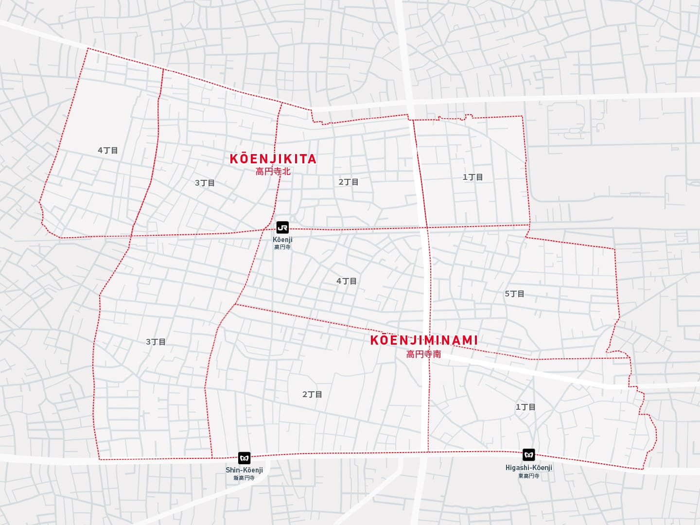
The area is divided into Kōenjikita (高円寺北, North Kōenji) and Kōenjiminami (高円寺南, South Kōenji), with the railway line through the station forming the boundary between them. Each is further divided into numbered chōme, the smaller address districts used to organise the area. Together, the boundaries form a solid, rock-like shape. From the station, shōtengai shopping streets fan out in a pinwheel pattern. Within this frame, elements of Kōenji’s character, including its counterculture roots and unhurried residential life, form a recognisable local identity.
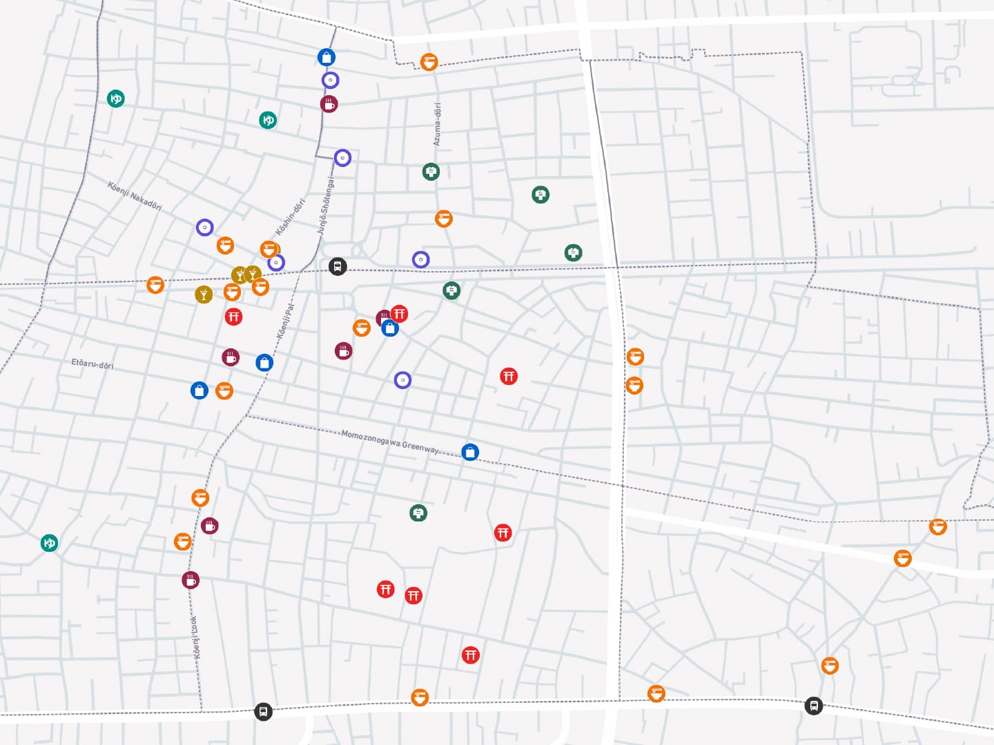
The guidebook’s routes are organised around a series of milestones within each neighbourhood, which link the streets between them. To give our research walks an initial structure, I assembled a longlist of map pins, grouped them by category and assigned each an icon for quick reference while walking. The result was less an itinerary than a prototype route.
To build it, I studied Kōenji street by street. Laborious to some; therapeutic to me. Pins naturally clustered around the station, but our interest extended into the surrounding residential areas. I made sure to include locations that would take us towards the neighbourhood’s edges, from where we could work back towards the denser concentration around the station.
Some categories, including shrines and sentō, were limited enough to include every mapped example, while others required a narrower selection. Restaurants and cafés were one such case. Shopfront images proved particularly instructive, allowing me to respond to the same visual cues I might notice while walking: weathered awnings, shoji-screened doorways and modest, homely touches.
Cuisine provided the next point of reference, though I rarely studied individual menus. Instead, I aimed for a broad cross-section of subcategories while making sure not to miss local staples, such as ramen in Kōenji.
Online opinion inevitably factors into decisions about where to visit, but reviews and star ratings carried relatively little weight in my planning. Their sheer volume often made consensus harder, rather than easier, to discern. Ratings in Tokyo also tend to skew lower than elsewhere; five stars are not awarded lightly. I paid more attention to the number of reviews than to the average score, leaning toward places with a smaller digital presence over those with an overwhelming volume of feedback.
After weighing these factors, I decided which places to pin: enough to give the walk structure, but not so many that they dictated our movement. At that point, the map prototype was as complete as it needed to be.
Stage Two: On the Street
Eventually, the neighbourhood’s neatly framed view must be left behind on the laptop screen. At the desk, we appear to be in control, traversing streets by trackpad and making decisions without immediate consequence. Outside, the route begins to bend in response to conditions on the ground.
The streets presented more choices than our prototype could have anticipated, and surprises it could not account for. Memorable experiences began when we looked up from the smartphone and surrendered the plan. When a doorway was all we had to go by, it often led to a deeply restorative meal. A wayside shrine that we almost skipped turned out to be one of the most atmospheric stops of the trip.
In Kōenji, we were met with persistent rain. We spent those days juggling camera and umbrella, drying lenses and seeking shelter. The conditions left us with fewer clear documentary images, but moodier photographs of the neighbourhood subdued by rain. We worked up an appetite for hot ramen, while warmer days elsewhere called for cold soba. The elements came to influence not only our photography but also the milestones we selected for the guide.
Every decision in Tokyo seems to carry a high opportunity cost. The city is dense enough that choosing one restaurant, street or neighbourhood inevitably means passing over another. Yet even an apparent mistake has value, revealing the imperfections that a more manicured account of the city might conceal.
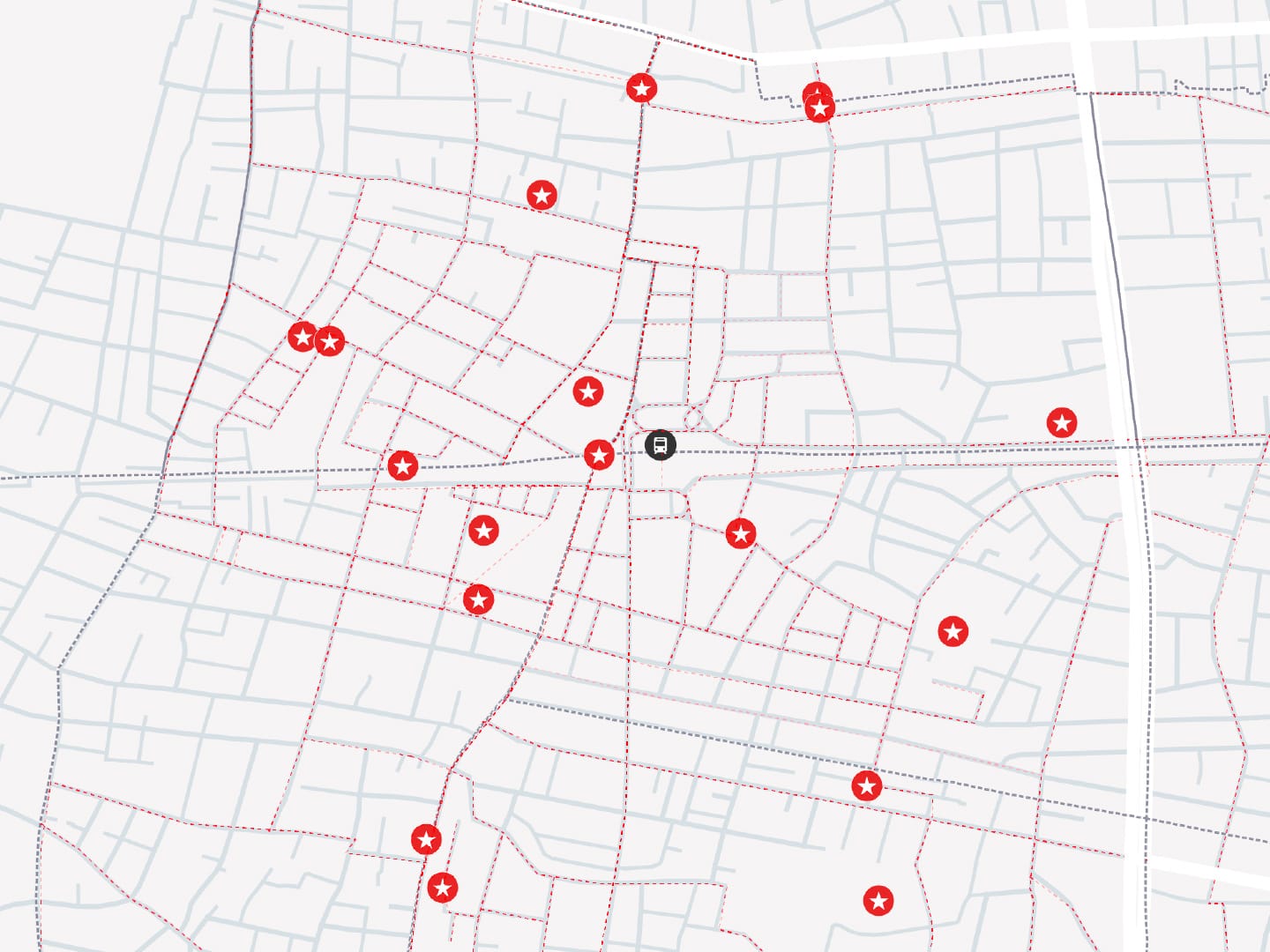
On the street, calculated planning gives way to intuitive judgement. Walking becomes less about completing the map and more about what lies between its gridlines. Through this exchange between prior research and direct encounter, we returned home with an extensive GPS trace, a record of our deviations and the beginnings of a guide that holds the two in balance.
Perhaps you never can see it all. But the completist in me is still drawn to Tokyo, a city that cannot be completed. The satisfaction lies in the pursuit: returning to the map, choosing another bounded area, and beginning again.
✺ Kiara
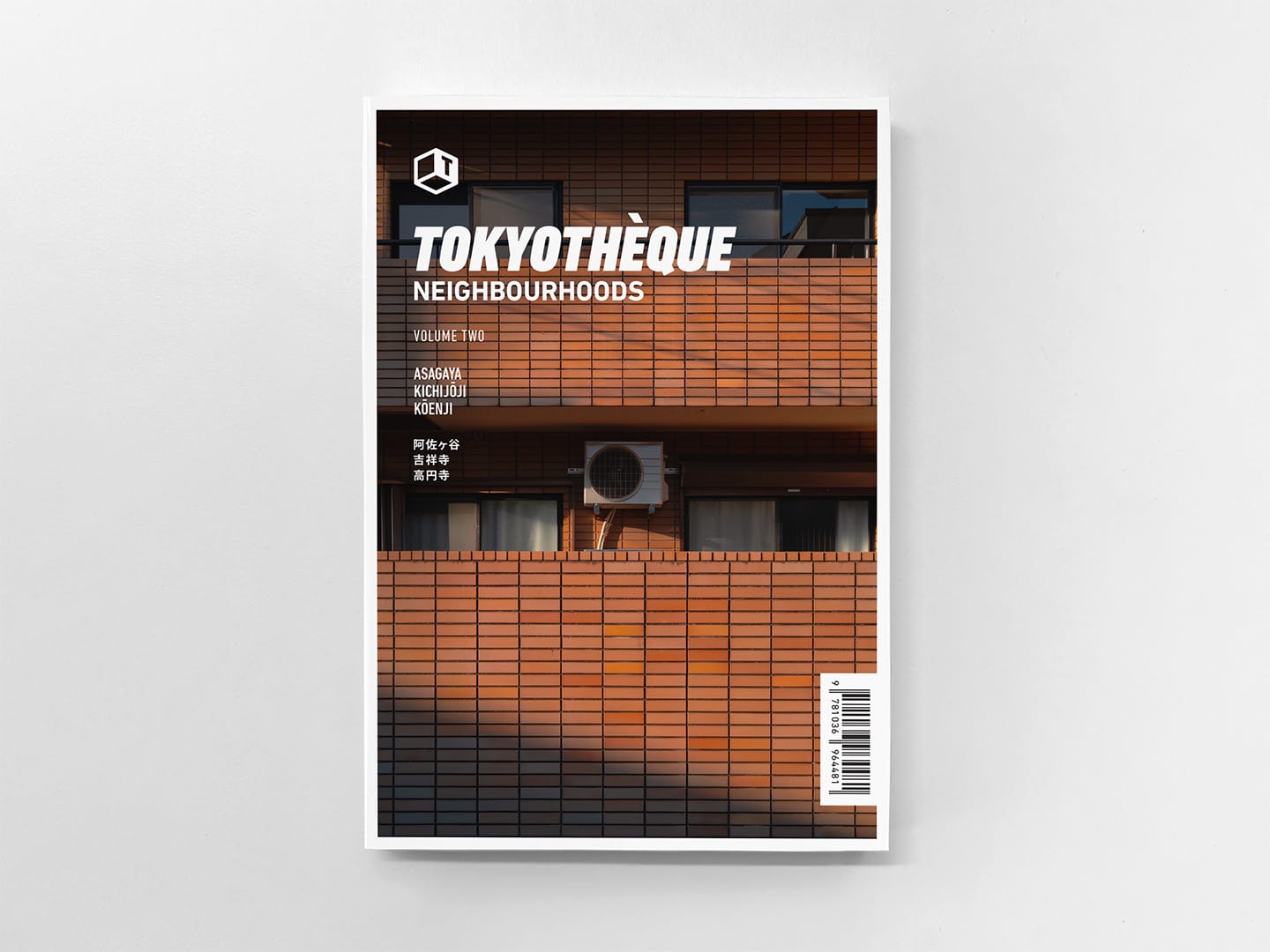
Kōenji features in the forthcoming Tokyothèque Neighbourhoods: Volume 2, a guidebook for encountering Tokyo one neighbourhood at a time.
Pre-orders are now open. Shipping begins on 1 October 2026, with the earliest orders dispatched first. Every pre-order will be individually numbered and signed.
Receive two volumes per year, complimentary shipping, and your name in the book with a City Walker subscription.